Tuesday, May 29, 2012

Alas, all good things must end...

It's time to go home, anyway. Every hard drive I have is completely full.

Worse, I'm beginning to hallucinate dinosaurs!

The past two days, the weather has been perfect, so I rushed around to all the best places and shot them again--without clouds!


If you look carefully, right under the curved swooshes of stone is a blue raft. Guardian angels on duty again!

Ten hours of driving tomorrow, so I'll be offline.It will be nice to get home and sort through 70 gigabytes of pictures and videos! (after some sleep)...

My Charley Brown moment...

After a couple of attempts to solve the Yampa Bench Road, today was to be the day. I drove to the eastern end (50 miles) then followed Yampa Bench into the country.

I have to admit, it was lovely country for cattle and horses:

My favorite guide book had said that there was a side road that led to a spectacular view of the Green River, which runs between the red sandstone cliffs and that white formation in this shot:


Charley Brown raced down the hill and headed for the football. Ah, but Lucy yanked it away! A chain was rigged across the crucial side road with a big sign that said, "Road Closed."

Score: Yampa Bench Road 53, aging moron still 0...

Still.I couldn't waste that sunny sky!  I raced to the Blue Mountain overlook, where signs complain bitterly about California's air pollution drifting here and reducing the visibility.


This was also a day to revisit Harper's Corner. I felt like sir Edmund Hillary!

Split Rocks was also bathed in warm colors, so I did a panorama to capture it.


Winding down today before the long drive to Vegas tomorrow. The sky is clear! Woo-woo!

Sunday, May 27, 2012

The best-laid plans...

The day started well, as the skies seemed to be clearing due to tornado-force winds. Even the locals were impresses. Oh, good.

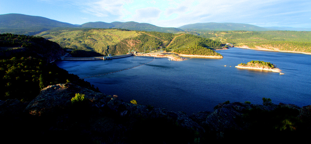
So I drove down here from Flaming gorge and went directly to the cliffs above the Yampa Bench/Echo Park Road: I wanted to drive the lengh of the Yampa Bench, a series of high cliffs above the Green River.

The wind was howling, but the Sun was breaking between the clouds! What a beautiful-looking day! What could possibly go wrong?


This was getting good! The sky was clearing! Only 42 more miles to go!


I was on a roll now! I--wait! What's that?

I skidded to a stop just before Ii slid into a deep gully full of water and mud that looked like quicksand. I got and looked at the gully. Then I looked at the Toyota, which exhibited no boat-like qualities.

Sigh.  I turned around, not wanting to be rescued--if anyone were working on the holiday weekend to do rescues.

Score: Yampa Bench Road 1, Ageing moron 0..

Since I was on the road that also goes to beautiful Echo Park (by the way,'park' is the teerm used here for a boat landing), I went there..

With sun still around, I tried to get a better sky for portraying massive Steamboat Rock:


As I left Echo Park, I passed near Whispering Cave,where there was this artistic rock formation;


Realing that the cloud cover was increasing,  I headed for the Iron Springs overlook. I had been there on two days earlier, but the clouds had taken the color out of a grand view::


The wind is blowing like a hurricane outside my snug bed-and-breakfast room Heaven knows what the morning will bring. I'll deal with it when I see it. I have this mad scheme to go to the far end of the Yampa Bench Road and see how far this way I can come..

The Gates of Lodore

Got out of Flaming Gorge at 6:45 A.M., which I figured would be plenty of time to beat the late-morning clouds.

Even from the parking area where the river rafters were gathering, the Gates are impressive.

Note the beautiful sky and ouffy clouds. Lovely. What I hadn't quite counted on was that the place is easy for rafters, butnot kind to ageing morons who want to walk the nearly two miles to get closer. Sigh. The 'trail' is unmarked or nonexistent, and I basically fought my way through the forest to finally reach a good  perch for photography.

My guardian angels were already there, sitting on the next rock.  "Boss! You're late! We've been trying to hold the !#!$!%!^! clouds back, but they are gaining on us. Oh, and we put some nice rafts on the river to help scale the scene."


Good girls. By now, the wind was coming up, the clouds were closing, and I still had to fight my way back to the parking lot. Ah, but first, a video!!

Note the rapidly-approaching clouds and their speed? A few minutes later, the whole place was entirely socked in. I didn't see the Sun again until I was back in Flaming Gorge at 3:30 P.M.

I won't dwell on the adventure getting through the woods. I did take a self-portrait with the little blood rivulets on both arms and both legs. Think of them as souvenirs...

The Gates are a one-trick pony, but it is a wonderful trick.

I should mention that I passed a magnificent overlook above the Flaming Gorge. The wind was howling at 40 miles per hour or so, but I managed to hold the camera still enough to get these:

You can see the back of the dam on the left.

Off today back to Jensen, near the entrance to Dinosaur National Monument.I have three more nights to do the fifty-mile dirt road atop the Yampa Bench and try somehow to get Harper's Corner without the clouds.

Friday, May 25, 2012

Another day of wonder...

The weather struggles seem to be generated by the 10,000-foot mountains. Early in the morning it tends to be sunny, the middle of the day is a horror, and the late afternoon clears. This is from yesterday, today only had rain and 40 mph wind.

I spent some time on the Sheep Creek Geologic Loop, a road through a museum of sandstone types. The pictures can't do justice to this place--the formations are huge!

When I first heard of this drive, I scoffed--but it was huge and impressive:

When the sun came out strongly, I raced back to Red Canyon to get another view:


This time, I happened to glance over at the next led just like the one I was on. Uh-oh.


When I mentioned the danger to a ranger, he shrugged philosophically and said, "We do tell people not to go outside the fence."

Oh, good.

To wrap up the day, a bit of contemplation on the banks of the 90-mile long reservoir.


Tomorrow, a trip to the completely remote Gates of Lodore.  can't wait!!!

SNOW?????????????

I suppose that is the final indignity when you come here just as their season opens. I overheard a conversation in which snow was mentioned in a town 30 miles away.
Sure enough, a few hours later I was in a flurry. Fortunately, the guardian angels did their thing and the skies cleared.

The 90-mile long Flaming Gorge reservoir was formed by building the Flaming Gorge Dam:

Behind the dam, the lake stretches its sinuous way North.


Driving North on a great sweeping road, I stopped (between snow flurries) at some sublime overlooks. One of the most impressive is that at Red Canyon:


There is a promontory between that view and this next one, so it won't all go in one big panorama. I hate falling from great heights.


Yes, a pair of speedboats were cruising down the Green River as it flows Southward toward where I was in my last post. After taking that shot, I headed North on the highway toward where the snow had been reported. I did take a couple of videos, but they are too depressing to show.

Instead, here's a view from a mountain about 30 miles North of Red Canyon:


As you see in some of these, I was really dodging clouds looking for any breaks to get some color in the images,

Just stepped outside to look at the new day, and saw--clouds. Sigh. At least there's no snow yet...

Wednesday, May 23, 2012

Top of the World!...

Despite battling uncooperative weather, I made my way to the highly-praised Harper's Corner. A friend told me that this was second only to the Grand Canyon for a view--she was right! Harpers is very similar to Toroweep on the North Rim--3800 straight down to the river. Also as at Toroweep, the photographer stands on a very precarious perch. Here is the view off one side:

That was the view of the Green River running North. If you turn around (be careful, that rock is very narrow), you see the river flowing South--with some small boats navigating it: I struggled with passing clouds, but my luck brought just enough patches of sunlight to bring out the color in the landscape.


Far below the South face of the Harper's viewpoint is a deep gorge, which shelters a paradise known as Echo Park (also called 'The Center of the Universe')  The deep valley is reached by a tortuous 12-mile road:


One attraction along the road to Echo Park is a high escarpment which contains a fifty-foot long cave known as Whispering Cave:


Whispering Cave is narrow and drafty, and suffused with reflected light.


That wall which soars above Whispering Cave is typical of a series of immense cliffs that rise above--and surround--Echo Park.


However--the precious gem at the heart of Echo Park is Steamboat Rock. The explorer John Wesley Powell was almost killed attempting to climb Steamboat Rock


My guardian angels intervened at several moments, delivering breaks in the awful cloud cover just long enough to light up my subjects when I was getting desperate.

Driving North in the morning to Flaming Gorge and thre Gates of Lodore for a couple of days, then back here to explore the Yampa Bench Road, which runs for fifty miles along those high cliffs above Steamboat Rock. The locals tell me the clouds should clear.

Tuesday, May 22, 2012

A fabulous Dinosaur Quarry and other wonders

Today I worked the endless dirt roads of the western part of Dinosaur National Monument, but first I stopped in at the Quarry building with its amazing display. This modern building is a brand-new replacement for an older one which fell victim to erosion under its foundation.

The quarry is supported by both the university of Utah and Brigham Young University. It houses an utterly amazing 90-foot long wall of stone with dinosaur bones sticking out of it everywhere!


Dinosaurs were largely herbivores, with relatively few carnivore predators.They apparently moved in loose herds and gathered at water holes, perhaps explaining enormous concentrations of bones in relatively small areas.


Of course, there were predatory Allosaurs here, and a well-done exhibit celebrates the big raptor:


Then I was off to Split Mountain, where the Green River carved its way right through a massive mountain


I went North on the Island Park trail, which involved 50 miles of dirt washboard road. My poor car. Ah, but there was Island Park, whose name is self-explanatory. I'll have a real panorama when I get time at home.


Then a sudden front came through. Clouds blocked the Sun, and the wind just howled. Sigh.  Tomorrow's area is really spectacular in bright sunlight, so I'm hoping the skies will clear!

I'll re-do these pictures when I get home for better quality, but this is a sampler of some on the fly.

Monday, May 21, 2012

Fantasy Canyon near Vernal, Utah

While I just hate to push yesterday's ring of fire images down the stack, today was another adventure.

Fantasy Canyon is an unusual aggregation of eroded sandstone, somewhat like Goblin Valley. There are formations like these in an area of a few acres. The formations are pretty weird in their visual effect:

Many of the formations have pet names, which I'll try to append later.


This is one I suspect most of my friends will never see. To get there, you cross fifty miles of desert like the moonscape below, which is dotted everywhere with small automated oil drilling and storage sites. The roads are hard-packed dirt, and big 18-wheelers are racing up behind you constantly.

You see a small section of the teeth-rattling washboard road here, and after driving it, the thing seems to go on forever.

Given all that, Fantasy Canyon isn't exactly crowded: Yes, it's a Monday, but I'll bet it's like this on Sunday, too.

So enjoy my new little friends! I'll add more when I get home and have time.


Now, this is imaginative erosion!!


Off to Dinosaur tomorrow!

Sunday, May 20, 2012

Ring of Fire-May 20, 2012

Since I was scheduled to drive to the northeastern corner of Utah in May 21, why not add a day and stay in charming Cedar City? It's a lovely place, and it was right on the track of Sunday's annular eclipse!

The impetuous fool wins again!  I now have a few hundred pictures of the two-hour-long sequence which I can work on when I get home. First, I'm driving to eastern Utah on the Colorado and Wyoming borders, to Dinosaur National Monument, the Gates of Lodore and Flaming gorge.

Until I get back, here are a few images of the eclipse, including the 'Ring of Fire' moments We begin with the early shadow moving across the disc:
.'

Then I'll go directly to the main event--the Ring of Fire: The Earth turns dark, and a spooky light pervades the land.

Then, as the shadow leaves:


And finally, as the Sun is about to go down behind a mountain-top on the horizon, the shadow clears!  Note what appear to be immense solar flares!


Much more when I have time at home. Off to Dinosaur National Monument and Flaming Gorge!