Saturday, November 14, 2015

...and then the Sun came out...

...and the weather became almost Spring-like. Bless those guardian angels!

The Sun was still low in the November sky, so the color and contrast weren't the best--but the subject matter was awesome!

First was by base in Window Rock. This rock marks the seat of government for the Navajo Nation. In the afternoon Sun, it is gorgeous!

 
I took the drone in for a closer look at the Window:
 
 
Earlier that day, I had driven North to Round Rock to re-visit Los Gigantes--without the wind:
 
 
Los Gigantes are seven miles East of the highway, while Edna's Needle and Hope Arch are nine miles West of it. Here's lonely Edna's Needle:
 
 
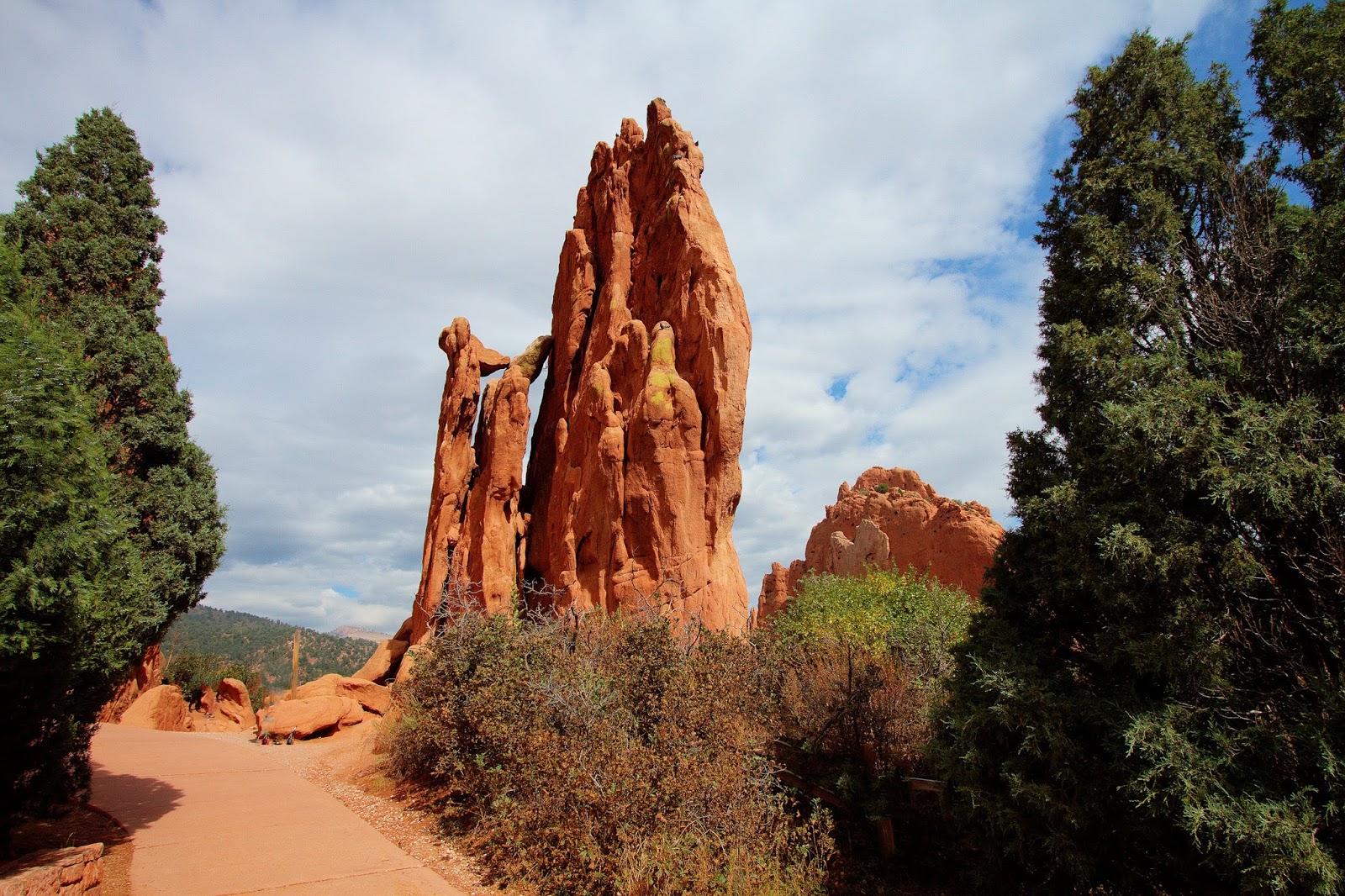
It is worth hovering just for a moment to view this unusual formation in the middle of nowhere.
 
 
Edna's Needle is about halfway from the car to Hope Arch. Falling out of Hope Arch almost killed me two years ago, so I give this remote formation the utmost respect. It seems annoyed at all times:
 
 
Still--let's fly over from Edna's Needle and visit:
 
 
There's more, but I'll put the rest up on my 'Most Recent' site at Phanfare.
 
More adventures soon!


Thursday, November 12, 2015

Bonus pay for the guardian angels...

They did it again.

The big storm and cold passed on toward the Midwest, and the skies cleared here. By midday it was cool but sunny--though the color values in Winter aren't the warm, rich colors of Summer!

I can't stand the lousy Internet access here, Very hard to get anything done but email and web browsing. Welcome to Navajo Land!

Try my Phanfare site, where I uploaded some tiny versions of the pictures I clipped from the videos. http://divexprt.phanfare.com/7069548

Everything else after I get home...


Wednesday, November 11, 2015

Out of the frying pan...

This will be shorta nd sweet, because the upload speed here is 3 to 5 KILOBYTES per second. At home it is 600/second.

So, I managed to put some tiny bits on my Phanfare site:  http://divexprt.phanfare.com/2015/

You can feel my pain over there...

Monday, November 9, 2015

A quick post before heading to Window Rock...

The weather was good yesterday, so I did some flights to take full advantage of it. For the temple-like formation on top of Cathedral Rocks, the drone had to go up 400 feet and out a half-mile:

 
Then some short sequences of the fading Fall foliage:
 
 
A quick stop by to see the dramatic setting of the Chapel of the Holy Cross:
 
 
And even a selfie!


More later. Time to hit the road!


Sunday, November 8, 2015

Trying hard to beat Winter...


The second day featured another icy morning. Fortunately, Winter hasn't yet iced the daytime. After the Sun is up for an hour, things improve greatly. This video is of Bell Rock, a favorite for families because it is easy to climb up the ledges.

I have a sweeping view from up here around to the Chapel of the Holy Cross, but it is too large a file for Blogger. Please see that really gorgeous sequence on my Phanfare site:  http://divexprt.phanfare.com/2015/

 
Later, the wind came up, so I sought out a formation which shielded the drone a bit. This is the Dry Creek area, which has an overlook and these scenic cliffs. Again, I have a longer clip of sweeping around from these formations to look out over the huge Red Cliffs/Boynton Pass area at my Phanfare site:  http://divexprt.phanfare.com/2015/
 
 
This morning looks pretty good as the Sun rises.
 Going to try a new park area near Oak Creek and see if I can video the last of the Fall foliage.
 

Saturday, November 7, 2015

Miracles actually happen...

My friends and family laugh and scoff when I tell them that my guardian angels intervene on many occasions when things could go bad.

Yesterday was a perfect example; I went to the Midgley Bridge and decided to fly out over Oak Creek Canyon to get video of its sunny side. The new Inspire Pro has a narrower angle on the camera's lens, so I backed up in order to get both the bridge and Steamboat Rock in the frame.

I'll leave what happens next for you to decide whether this was Divine Intervention...

 
Early in the morning it was 29 degrees, and Flagstaff (a few miles North) had six inches of snow yesterday. Yet by afternoon, temperatures had soared to the mid-70s. I raced around visiting scenic spots that were basking in richly-colored sunlight.
 
'We're off to see the Lizard'...
 
 
Then there was that old favorite, Chimney Rock.
 
 
Then to the Wilson Mountain area, which lies just outside of the city to the North.
 
 
Cathedral Rocks are particularly beautiful in the afternoon:
 
 
Weather for the weekend forecast warm and sunny.  The guardian angels are still on duty...
 

Monday, October 5, 2015

Captain Drone bails out...

.and heads for home. No more fighting dreadful weather chasing elusive patches of Sun. No more having the drone banned by bureaucrats! Goodbye, Colorado!

To be realistic, there seems to be bad weather across huge sections of the country. What I struggled to get through only seemed personal to me.

Having decided to bail out, I drove west from Canon City, over the mountains and then through the Curecanti Recreation Area, flying the drone over the twenty-mile-long lake under bleak skies. I'd have killed for bright Sun! This first clip is toward the center of the largest lake in Colorado, Blue Lake:

 
And this section of the lake is found at the western end, right next to the Black Canyon of the Gunnison:
 
 
And wouldn't you know? I had patches of bright sunlight in areas East and West of Curecanti, but not at the lake!


Well, I'll never visit this state again, but at least I leave with a few colorful memories!

Overnighting back in Grand Junction, and will take the drive across Utah to Vegas tomorrow.

Sunday, October 4, 2015

Yesterday began as badly as prior days--fog, drizzle, complete overcast. I was on the verge of canceling the rest of my trip, but stubbornness won out.

I drove West for forty miles along the Arkansas River. Highway 50 follows the river toward the Black Canyon of the Gunnison.

After ten miles, the clouds evaporated, the blue sky spread from horizon to horizon, and color erupted. everywhere. At pullouts which offered good landing areas, I put the Inspire drone up for forays up and down the river. Here are a couple of samples, but the day's clips are at my 'Most Recent' gallery at http://divexprt.phanfare.com/2015/


That is the Vallie Bridge, which I then viewed from the sky. First I sent the drone toward the East:

 
Then, of course, I had to bring in back toward the West and over the bridge:
 
 
Here's another flight over bucolic farmland. These are all I'll put here, but would-be drone pilots and masochists can visit the 'Most recent' gallery. Again, that is at http://divexprt.phanfare.com/2015/...
 
 
I suspect that yesterday was one of those perfect days between storms, because the forecasts have been uniformly lousy. We'll see when the Sun comes up this morning!


Friday, October 2, 2015

The Fearless Fossil outmaneuvers a lousy weather day...

When the weather early in the day is rainy with dense fog, what can you do?

Here in Canon City, you gain altitude and get above the weather by driving South to Bishop Castle.  http://www.bishopcastle.org/#

 It is astounding that this is one man's project, which has so far taken him more than thirty years.

The high towers were too tempting to miss, so here is a grand tour conducted by the Fearless Fossil--who, I am relieved to report, did not fall off the high balconies. At this age,  I consider that a good day.

The layout has us climbing stone stairs to the Memorial Hall, whose stained-glass panels remember people who have passed. Up another story is a huge hall which some local visitors told me is now used for weddings.

Then we begin the ascent to the towers using steel spiral staircases and forays out onto the metalwork balconies.

  Here we go! First the classic façade:

 
and another view from the side:

 
That dragon face is the chimney from the big fireplace:


Step out on a balcony and see the turrets soar into the sky:

 
Those ctwalks are very solid. Mr. Bishop was an iron worker:

 
The higher we climb, the more exotic the battlements:

 
From the towers, we begin to get fabulous Fall foliage views:

 
The interior halls are magnificent: this one is the rear of the ballroom.

 
These are the stained-glass panes in the Memorial Hall:


The dragon head is the main chimney!

 
Uh-oh. Time to climb to the to of the high tower...

 
Those spiral staircases are also very solidly built--than goodness...

 
Express your inner mountaineer! (young people only, please). 
 
 
What a view!

 
Uh-no, I didn't climb up there...

 
The view down the spiral stairs.

 
To the main wedding hall:

 
Here's the rear of that hall:

 
There is always another spiral staircase until you finally hit solid ground.

 
So--after a day above the clouds, I drove back down into the rain and fog...
 

Praying for better weather tomorrow--but the Bishop Castle surely saved today!

Looking for good weather in all the wrong places...

I did get one break today. When I went in the afternoon, the wind was howling at the Royal Gorge bridge. Flying the drone yesterday when it was windless was a happy decision. Today I did the walking bit:

The bridge is impressive from any angle! You can walk across and stare back at the span:


Or be lucky, as I was, and have a convenient train pass far below while you watched!

 
Woo-woo!!...
 
 
They have zip lines and cable cars strung across the gorge, but it is now off-season, so nobody was riding them. They also have a giant swing hanging from this frame. One shrieking female rode it a couple of days ago, but I've seen none since.
 
 
Earlier, I went back to the Garden of the Gods hoping for better sunlight. Good luck with that. Even at mid-morning the light wasn't much. This the first of the main formations we encounter, with the Kissing Camels atop it:
 
 
Actually, I came in early in the morning and put the drone up, but was almost immediately accosted by one of the Pothead State's employees.
 
 
Dropped by Balanced Rock:
 
 
and the Central Garden before getting out of town:
 
 
The weekend forecast is ugly, so I'm racing off to new targets today. Guardian angels under great pressure...


Wednesday, September 30, 2015

A tense episode of...

The Fugitive  That's me.

First on a lousy, cloudy day, I chased elusive patches of sunlight at Colorado Springs' Garden of the Gods. This was about the only sunlight I saw all morning, but I learned a lot about where all the formations were. Will definitely come back when I can get good lighting.

Here are some formations from the Central Garden:


The clouds moved in soon after I took those, so I drove further South for the Royal Gorge Bridge. While the sunlight was weak, the winds were very light.
 
I was eager to get some drone footage, I set it up, and--another miracle! My guardian angels delivered again! Suddenly I had a five-minute patch of pretty good light. Vroom-vroom! Up she went!
 
 
Before landing, I flew closer for a final view of the bridge and its deep gorge from the center of the crevasse. What a view!
 
 
And now for the Fugitive moment. I was anxious that the drone might be seen and the park wouldn't like the intrusion--even though everything I have read told me that flying at the gorge is legal. I had the car parked under trees out of sight, just in case.
 
Suddenly, five minutes after I hurriedly packed the drone into my car, I heard a helicopter. It was  flying close to the cliff atop which I was parked. It circled fairly close, but at the cliff edge rather than up over the trees where the car and I were.
 
I don't believe in coincidences, so the minute it turned away toward the visitor center I got out of there--relieved that no cars with flashing lights appeared in the rear-view mirror as I took off down the exit road.
 
Tune in for more pulse-pounding excitement tomorrow!
 
Oh, Thunder and lightning are going on outside...


Tuesday, September 29, 2015

Desperately searching for Fall colors...

Well, yes, they're around--up at 10,000 feet! This was near Breckenridge ski area. The Dillon Reservoir surface is at 9,000 feet. The surrounding hills tower up another thousand feet or more.

I'm hoping that over the next few days the color moves down to drone-flyable altitudes.


When I get some nice sunshine on all these hills, I'll have the GoPro and my Canon for HDR images   ready.
 
 
By the way, since my new motel here in Canon City has a fast wi-fi, I'll add some of my nice Grand Junction videos flying above the Colorado. This is a small lake next to the Colorado near the town of Fruita.
 
 
This is near that lake near Fruita, where a road enters the West end of the Colorado National Monument, flying up to view the Colorado River looking West, then East:
 
 
And a leisurely flight above the peaceful Rifle Reservoir:
 
 
It's raining at the moment. Let's hope that means Sun tomorrow!
 
 Meanwhile, I'm staying at a very comfortable motel at which I seem to be the only customer.
 
Hope this isn't the Bates Motel...
 
The motel is run by a very pleasant Japanese man--I realized after a while that his clientele probably all arrive in big buses filled with Japanese tour groups. Group travel is their preferred mode of overseas travel.


Getting in gear for the Supermoon eclipse...


The Supermoon eclipse was as much of a wonder as I had hoped it would be. I stood under the stars atop the Colorado National Monument, along with a retired State Trooper named Larry. We wouldn't let each other quit until we had gone through totality.

I had gone through a very long day, but with his help I persisted until 10:00 P.M. before I fled to get some needed sleep after we got images of the beginning of the Moon's emergence from totality.

I have another low bandwidth problem in this motel,  so I'm praying that this sequence of much-downsized images makes it through the upload and hints at the marvel millions witnessed. I have all these as originals, plus many more of the full-sized shots, so it was a successful shoot.
:


Then today, what was left of me hit the road to Rifle and flew over the Rifle Reservoir. I'll take the plunge and see if the bandwidth can deliver the video version of that flight. Otherwise, it's a still photo to hold the fort 'til I get home.
 
Later bulletin: After uploading all night, a short video still wasn't uploaded. This is more pathetic service than in Twin Falls!
 
Here's a still from the Rifle reservoir video:


Then from Rifle in the East I drove to Fruita in the West of Grand Junction to fly the Inspire over the Colorado River and a number of side lakes and agricultural water storage ponds near it. The first clip is looking toward the East, the second West.


The remarkable thing this year is how late the Fall foliage is. I've seen some nice patches of color far up on the higher mountains, but none in the areas in the valleys where I was flying.
 
 Stay tuned for the videos until after I get home. Sigh.
 
Out of here soon for new adventures!