Wednesday, October 29, 2014

Except for very unreliable Wi-fi, all working out well!...

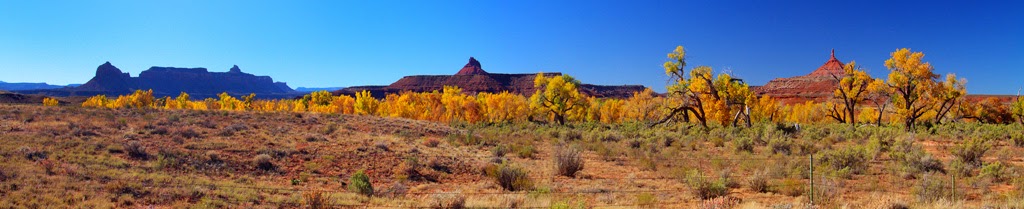
Had a pleasant day South in the Needles section of Canyonlands.  Nothing sensational, the Fall foliage is fading and stone formations are stone formations.


Far in the distance is the Island in the Sky portion of Canyonlands, where the spectacular cliffs are.


As I said, stone is stone, even when it is the Wooden Shoe Arch:

 
There were still some patches of aspen near stream beds:
 
 
Some kind of water is a prerequisite, it seems: 


I stopped at the Looking Glass Arch:
 
 
I climbed up to the rocks just outside the arch, but remembering my terrible fall at Hope Arch in June (the left arm still hasn't recovered), I stopped there.
 
 
Off to a couple of interesting areas today, then will head home on Friday. Email will be spotty, at best...


Tuesday, October 28, 2014

Welcome to Moab...

We'll see how long this connection lasts. They must have just rebooted the system. It may work for a short while.

I'll quickly toss up a few stills, as I suspect putting up nice videos will bring the system down.

Here is lovely Castle Valley, in Fall colors:


A big bend in the Colorado at Horse Ranch:


And another, called Hittle Corner:

 
And a couple of drone flights over the river. First some 25 miles upriver from Moab:
 
 
Then I turned the Phantom to look upriver from the same spot:
 
 
Several miles West from that corner is a long straightaway:
 
 
I won't push my luck here. the Wi-Fi is creaking and groaning with only a few stills--the videos will have to wait...
 
Hope you get to see this!


Tuesday, October 7, 2014

And for my final trick...

How about driving home via Mount Whitney, the famed location (Alabama Hills) where so many movies were shot, and Death Valley?
 
Here's Mount Whitney from Alabama Hills in a panorama:
 
 
You can see why Alabama Hills was such a favorite for making movies for Hollywood, This kind of scenery only 400 miles away with excellent highway access.
 
Alabama Hills has several small arches, and this astonishing arch called the Mobius  http://en.wikipedia.org/wiki/M%C3%B6bius_strip which by fabulous chance frames Mount Whitney perfectly!
 
 
For another experience, I went up the Mount Whitney switchback road, which you can make out Almost in the center of the picture.
 
 
On the way down. I turned on the GoPro to give a flavor of the seven-minute drive down the mountain. Here's a short sample::
 
 
Then it was off to Las Vegas by crossing Death Valley National Park. The road goes from 5,000 feet down to 100 feet below sea level (!) and then back up to 5,000 feet. It does that twice!
 
Here's the view from 4,000 feet on the West side.
 
 
You can see the road sweeping down toward sea level. Here's how it looks when you're driving it (The entire ride takes 14 minutes, so this is just a small clip):


And so the two weeks ends. All in all, lots of exciting, colorful subjects, which I can work on in coming days.
 
That's all, folks!


Sunday, October 5, 2014

Adieu to the East Slope...

The trip has been very fulfilling, but it's time to sound the retreat after 80 gigabytes of material to work on in coming days.

I went down to Convict Lake  South of Mammoth Lakes this morning. The lake has an interesting history right out of the Old West! Sorry for the shadow on the sign. The short version is, the posse caught up to the escaped convicts here, and the Sheriff was shot (note the misspelling of 'Sheriff' on the sign. You just can't get good help these days).


And what a place for a shootout!

 
From Convict Lake, I went a few miles down the road to Crowley Lake, but the photography from ground level wasn't much. A kind employee told me to drive up McGee Creek road for a better view. His advice was, as that of locals so often is, invaluable!
 
 
That view must be something when those mountains are covered with snow!
 
 
Cars kept driving past me up McGee Creek road, So I became curious and followed them. At the very end of the road, I found that this was a trailhead for hikers to park their cars while they went up into the mountains.
 
Ah, but the drive itself was a rich experience!


Tomorrow, Mount Whitney, the Alabama Hills (where many of the old-time western movies were filmed):


After that, I cross Death Valley on my way to Vegas.
 
Time to go home to Kansas, Toto!


Saturday, October 4, 2014

The Case of the Dead Duck...

This is the episode in which the detective tells you how he solved the crime, winning oohs and aaahs from the audience.

Not this time, alas. Remember that research I bragged about yesterday? Well, it had a fatal hole in it.

I planned this trip long before the Phantom was even released. When I got the drone, I just assumed it would fly wherever I put it up. When I came here, my test flights at Mono Lake were flawless.  I kind of assumed that Mono Lake was at an altitude of maybe 5,000 feet and the lakes were somewhat higher, perhaps at 7,000 or so.

Wrongo. I discovered my awful error when the Phantom went up at Big Virginia Lake:

 
At high altitude, there are barely  enough molecules of air for the propellers to provide lift. That's why helicopters have trouble in high-altitude rescues. If the helicopter descends even slightly into its own turbulence, it is called Vortex Ring state, and the copter immediately displays the aerodynamic characteristics of a stone. It falls into dead ducksville.
 
You see, I was wrong about those altitudes. Mono Lake is at 6,372. Alpine Lake is at 7,303. Lundy Lake is at 7,858. And Big Virginia Lake, shown above, is at 9,770.
 
And so I launched the Phantom from a hill above Big Virginia and sent it up over 10,000 feet!
 
 
It ascended perfectly, hovered to shoot the material, but as I gently brought down in the falling leaf pattern, it swooned into a Vortex Ring state. I won't talk about the dead duck part. It was gruesome to watch, but the tough little drone somehow survived its near-death experience...
 
On to more pleasant topics. Today was magnificent! I only have room to show a few tidbits. The colors were coming out in many groves as I drove about:
 
 
Ellery Lake was like a mirror!
 
 
And Walker Creek up at 10,000 feet in Tioga Pass was exploding in color.
 
 
Lundy Lake had broad patches color along its banks;
 
 
Even driving back to my cabin was a color riot!
 
 
One more gorgeous weather day here, then the long drive home via Mount Whitney and Death Valley.  Much to do, with over 70 gigabytes of material--so far!
 

Friday, October 3, 2014

When all the research pays off...

Today was a pleasure. Cold as Antarctica in the dawn hour, but T-shirt time by 10:00 A.M. Love it! So, I raced around trying to collect some good material.

Fall Foliage! I want some Fall foliage!

 
Still the best place I have found after a week of searching. But, the color is spreading...
 
 
Towering above, there are the mountains of the Sierra, including this massif on the road into Yosemite.
 
 
By the by, last evening I was so tired I forgot to include the Phantom's
 
mission over Lake Alpine! It was peaceful and quiet, closed for the season--a joy for a few fishermen...


Just for fun, this is a portion of my drive home from 'work' each day:
 
 
There is a lot of material that I haven't even screened as yet, but I'll catch up tomorrow. I keep finding little treasures I missed. For example, here's Leavitt Meadows, seen from Sonora Pass::


I'm extending my stay two more days to make up for the days I lost to rain and wind early in the trip.
 
Stay tuned! 


Thursday, October 2, 2014

Nice day in high altitude...

Today I drove North a total of three hours each way, but with many photo stops. Finally, I'm seeing some larger groves of colorful trees, and hope the Fall colors will finally arrive before I run out of days. Tick, tick, tick...

This is a nice grove atop Monitor Pass. Almost all of the color so far has been quite high. For my purposes, I need that change to spread down near Mono Lake.

 
At the farthest point of my drive, I stopped in at Lake Alpine, nearly deserted and placid after the end of its season:
 
 
For the rest of the ride, I enjoyed high mountain vistas and zillions of fir trees:
 
 
There were lakes everywhere, including this one--which had a small welcoming committee!


Lots more, but no time to process them until I get home. We'll call this the 'lakes' trip, because there were so many!
 
. This is a small reservoir right beside the road East of
Ebbetts Pass:
 
 
Finally here's Topaz Lake on the main North/South route East of the Sierra.


Tomorrow, the real search for Fall colors--now that they are finally appearing! I'm down to three days!!...