Monday, June 28, 2010

Panoramas and videos...


This panorama is one I've been looking forward to assembling. It is made up of 27 shots in 8 HDRs. The first time I tried to assemble it, my big computer complained that it didn't have enough RAM. (It has 4 Gigabytes of Ram).

The open space of Upper Cathedral Valley is immense, and I hope this gives some idea of what it is like to stand there and look around. Remember to click on the image to see the larger version.

Below is a quick video of driving along the Hogback Road, which runs between Escalante and Boulder in Utah. This road passes Calf Creek (site of the famous waterfall) and then runs for thirty miles before reaching Boulder.

There is a 1,000-foot dropoff on either side of this road, so it is great fun to drive it with a video camera out the window.

Sunday, June 27, 2010

The Toyota Mutiny ends...


The Toyota Mutiny ended with a whimper. The cheap floozie. She developed a complete attitude transplant--all I had to do was drive her to Vegas and run her through the deluxe car wash with wax. Hmmph.

This glass structure above is what happens when gypsum flies down from the sky. There is also a huge sinkhole in the Upper Valley where a large deposit of gypsum broke down into a superfine white powder and blew away. The hole is 200 feet deep! More about the magic of gypsum in a later post.

There are also round black boulders everywhere, blown for miles when Boulder Mountain erupted fifty million years ago.

No wonder there is a lot of mining here (wherever the !#!$!%! government doesn't ban it). The mountains are layers upon layers of minerals for miles around!
Nature also has some sense of humor in her designs. This one below sure has some resemblance to a ship cutting through the sea...


Yesterday, I visited Upper Cathedral Valley with its astonishing wealth of formations.

At the end of the day I left the park via the Lower Cathedral Valley. These two monoliths, the Temple of the Sun and the Temple of the Moon, dominate a broad valley--and the glass mountain site is only a quarter-mile away.


They do make a pair! Below, the image in the foreground is the Temple of the Moon, and the Temple of the Sun is in the background. Still, as long as the Sun is out, it's hard not to take a good picture!


I just got home with 65 gigabytes of stills and videos. That will take a while to digest, but should produce some interesting panoramas. And--what was I going to do through the hot Vegas Summer, anyway?

Saturday, June 26, 2010

The Toyota Mutiny...


Oh, all right--the rain last evening was good for something.

As for the Toyota, I could have sworn she screamed as I turned toward the river ford; she knew what that meant. Hours of punishment on that road. I'll give a medal l to somebody at Toyota if I can find the right person.

In any event, the sun was brilliant when we got to the massive monoliths in northern cathedral Valley. These structures stand several hundred feet in height, and nearly rival those of Monument Valley.

You can drive close to them--but then you have to back up because they overwhelm most lenses.

Cathedral valley itself is vast, and surrounded on all sides by sandstone formations.


Below, two couples were climbing to that crevice as I was shooting the scene. You can see by the size of their car that these walls lining Cathedral Valley are colossal--as is everything about Capitol Reef!

More thrills and spills tomorrow--if the Toyota puts up with it all...

Friday, June 25, 2010

Mother always said there'd be days like this...


Yesterday was a sensational day--a deep blue sky for the drive from Escalante and a perfect afternoon for an initial foray into the park. I should have known that Mother Nature was luring me in.

Filled with confidence after that afternoon, I decided to undertake the arduous 70-mile circuit up to Cathedral Valley. That was my main target when I set up the trip.

So, the Toyota and I took off for the river ford--oh, did I forget to tell you that you have to cross the river to get to the North? Must have slipped my mind.

All went well for a couple of hours. The light was brilliant at the South Cathedral Valley overlook.

Alas, then the clouds roared in, the rains came, and I drove fifty miles of rutted, bouncy, rocky, treacherously twisting roads and took nary a picture. Well, when I got back to my starting point a bit of late afternoon sun bathed the hills above the park entrance--just to mock me. Grrrrr. Note the sky in the image below compared to the one above, taken this morning.


Of course, after that unintended 'scouting mission' I know where all the Cathedral Valley formations are now, so I can just do the whole thing again tomorrow or Sunday.

Of course, when I turn the car toward the river, she is going to look at me with those big, soulful headlights and roll over dead.

Major expedition today...


Each day is more spectacular. Yesterday I drove from boulder down the Burr Trail. Every mineral color you ever wanted to see.

Then I reached the seven-mile long wonder known as Long Canyon. As you see below, you drive this winding canyon amid walls of brilliant sandstone.


Until you reach the southern exit and look out across more endless miles of beauty.


The I took the drive up into the high mountains (well, 10,000 feet) and reached the entrance of Capitol Reef. Shot a lot of material, but I'll get to it--perhaps tonuight if I'm not too wrung out from the 60-mile 4-wheel drive up to Lower Cathedral Valley. I pray the car (which ages before my eyes each day) holds up. wouldn't want to get stranded out there.

the Disgraced John Edwards used to say there were two Americas. I have discovered the second one--no Fox News, no CNBC and I have sit here in the lobby to get Internet access. Suffer, suffer...

Wednesday, June 23, 2010

There are two posts today...


There were so many attractions today that I had to break the blog into two posts. these early pictures are from the punishing but beautiful drive from Escalante to the famed Hole in the Rock--which I'll show in the second post below this one. The road gets worse the closer we get to the Hole in the wall. And worse.And, as we get within a few miles of the Hole in the Rock, beyond worse. All along the road, we have to the West a massive escarpment, which obviously guided the trail the Mormon wagon train followed.

Along the way, we stopped at the Devil's Garden, a huge collection of strangely-shaped sandstone monoliths, arranged as a giant child would play with blocks. Nature shows a weird sense of humor here!

Then we arrived at Dance Hall Rock--this place is huge, a monster amphitheater in which the wagon train Mormons had their Saturday night festivities. Mormons had a lot of children. I'll move on.
Throughout the punishing drive even for his 4-wheel drive,, my guide Sean showed me places where the wheels of the 1879 wagon train to the Hole in the Rock left their marks. He was also expert at finding Indian arrowheads and other small traces of Indian habitation. The picture below is of 130-year-old wagon ruts!


It was a punishing but fabulous day. Please scroll down to the next post to see the Hole in the rock itself--an astonishing story of human spirit that would not be beaten.

The Hole in the Rock...

This is my second post of the day--there was simply so much to be covered in the day!

This location, The Hole in the Rock, was the reason for my 60-mile trip across the desert today.

Thank goodness we had a big 4-wheel drive vehicle. Sure, I could have come here on a boat on Lake Powell--but the way I did it, I feel I much better understand the Mormon achievement.
My Guide, Sean, is very knowledgable guide whose stories helped me understand this achievement. Getting 83 huge wagons down this slot in 1879 strikes me as in the league with Ernest Shackleton's 'Endurance' saga in Antarctica in 1911.

To top it off, that water you see wasn't there in 1879. This water level rose behind the Glen Canyon Dam, built after the Second World War. Those wagons had to go down 600 more feet to the level of the original Colorado River!

Again--how in the world did 225 Mormons, half of them children, get 83 big wagons down that slot?

Tuesday, June 22, 2010

Escalante is everything it claims to be...


It is an amazing place, and I have only started. this morning I took a 25-mile drive on a washboard road through the Dixie National forest. Anybody tells you America doesn't have a lot of trees, they're lying. My car is now 20 years old and hates washboard roads,

The target was Hell's backbone, site of this bridge and some colossal views. Worth every rattle and dislodged filling it took to reach it.

Came back down the nost Beautiful Road, which has countless overlooks like this one which is the site of the Escalante river trailhead. No, I'm not going to hike it, I still can't feel my legs from yesterday.

Speaking of yesterday's unspeakable hike, this picture is too small, but the trail runs along the bottom of that red wall across the way. I don't see any bodies on the trail. It creates them.

But, as always. the target is worth it. This is a shot of the falls from the left, and before all the families who were there jumped in. they told me it was icy cold. Everybody knows I don't dive in cold water.

Tomorrow is a big one, a 4-wheel drive to the famed Hole in the Rock Trail, where in 1879 Mormon settlers took 80 wagons down a 1200-foot sheer precipice to get down to Lake Mead. I've read what they did, but still can hardly believe it.

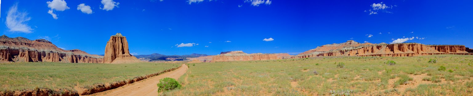
May be a late day. If so, I may not get a blog out for a day or two. I'm off to Capitol Reef National Park Thursday, by way of driving the Burr Trail, which plows about 30 miles of passable road South out of Boulder.

And, of course, on the way to Boulder I drive Hogback, the little road with the thousand-foot dropoffs on both sides.

No rest for those who always want to do too much!...

Monday, June 21, 2010

Nothing could be as dramatic as yesterday. Oh, wait...


Yesterday my Kodachrome Basin adventure ended with a climb up to Angel's Palace overlook, which as you see is crisscrossed with trails--I, of course, had to go to the highest. No remarks.

Then, this morning I stopped at Tropic Ditch, outside of Bryce Canyon, for a spot of morning hoodoos in the early sunlight.

This is along what they call here the Most Beautiful Drive in America. I'm down by the highway looking up toward High Point, the Red formation top left.

This is the view from up on High Point. I drove to my left from here. came into the picture in that row of trees on the right, and drove on down toward Escalante. I'm in a motel there for three nights.

And why come to Escalante? Among other attractions, this is the Lower Calf Creek Falls. It is a five mile killer hike, but the falls are beautiful when you get there!

What a day!


If anyone tells you to drive down Cottonwood Canyon Road to see the Grosvenor Arch, your answer is, "Great! We'll take YOUR car!" My 2008 Toyota Highlander is now fifteen years old.

Oh, all right. it is a pretty drive, even with the ruts and potholes, just because of the flowers.

The Grosvenor Arch is named for Gilbert Grosvenor, long time head of National Geographic, after is was discovered on a 1949 NatGeo expedition that also discovered Kodachrome Basin.


Meanwhile, the mosquitoes in Arizona told the mosquitoes here that I taste like chicken. There was an air Force here waiting for me, and I now have bites on every exposed inch of my glorious body--even my bites from the pond in Sedona have bites!


The bites will heal in a week or so, but the pictures will endure.

In the afternoon, I walked all over Kodachrome Basin State Park, but that will have wait for another post. This picture is of the Grand Parade formations, the signature attraction of the park.

And now, it's time to hit the trail to Escalante and my foray onto Mormon history...

Wednesday, June 9, 2010

Panoramas of Canyon de Chelly

While my webmaster Patty struggles with a mountain of new material, I am enjoying the power of fitting enormous tracts of desert into single photographs. This first one is the colossal view from the Mummy Cave overlook.


And yet, the original image is so huge it retains the detail of the centuries-old ruin under the ledge. I just love this software!
This next one is the amazing vista one experiences from the Antelope House overlook. If you look very carefully to the lower right, there are three trucks and a gaggle of visitors crossing the bridge to walk by the ruin.


It is an astonishing retention of detail--which of course comes from using 18 shots stitched together to make the large image.

These will soon be in a gallery in the Desert Photography section of my web site--with a lot of other fascinating views!


Thursday, June 3, 2010

Hoover Dam


When I go to Arizona from Vegas, I pass over Hoover Dam--but usually at dawn or late afternoon, never when the light is quite right.

So, today I took a drive over there to catch the mid-morning light on the Lake Mead side-- and then the sunlight just after Noon, when it pours down the immense face.


The new bridge to bypass the dam is now linked and shows up in some of the shots from below the dam This entire dam area is quite a tourist attraction; there seem to be thousands of people there every day, not just on weekends.


The still photo above and the video below is from the upstream, or Lake Mead, side of the Dam and shows the inlet towers.

.